SonarMapper turns your echo sounder recordings into lake and river maps with contour lines, volume and a PDF report. Easy to use, made in Germany for anglers, emergency services and clubs.
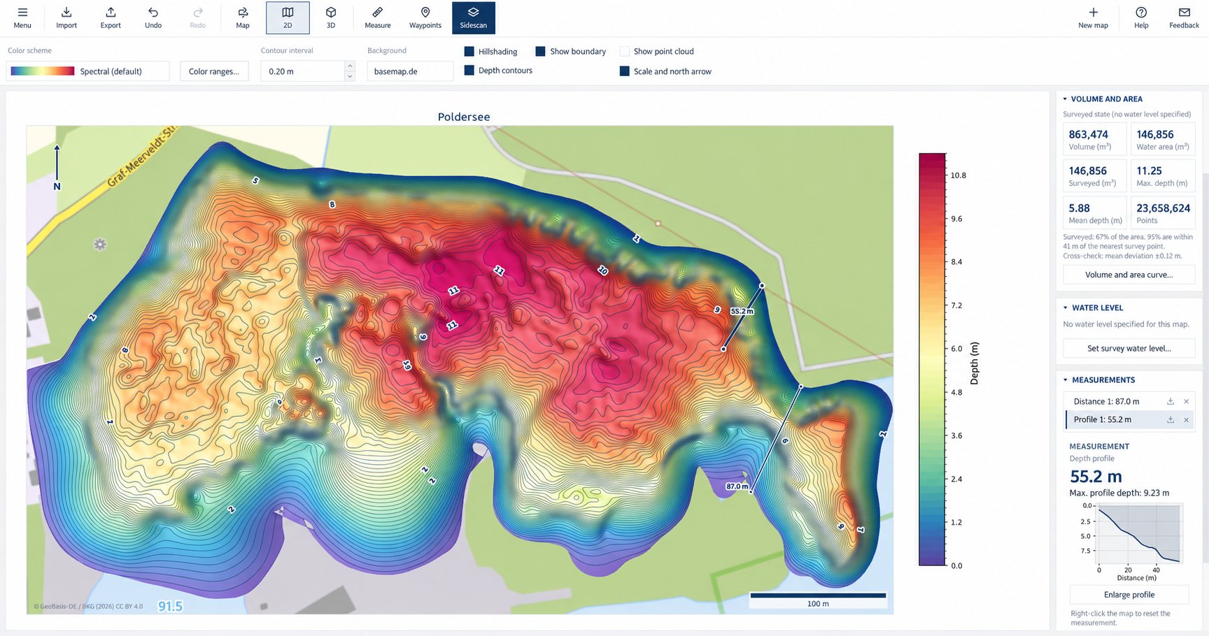
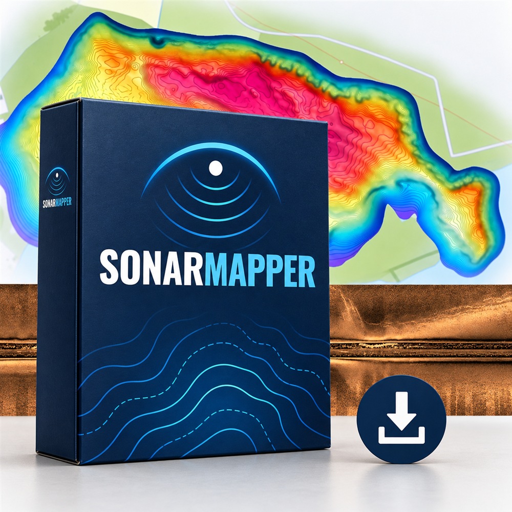
Depth map of a lake with volume, water surface and depth profile
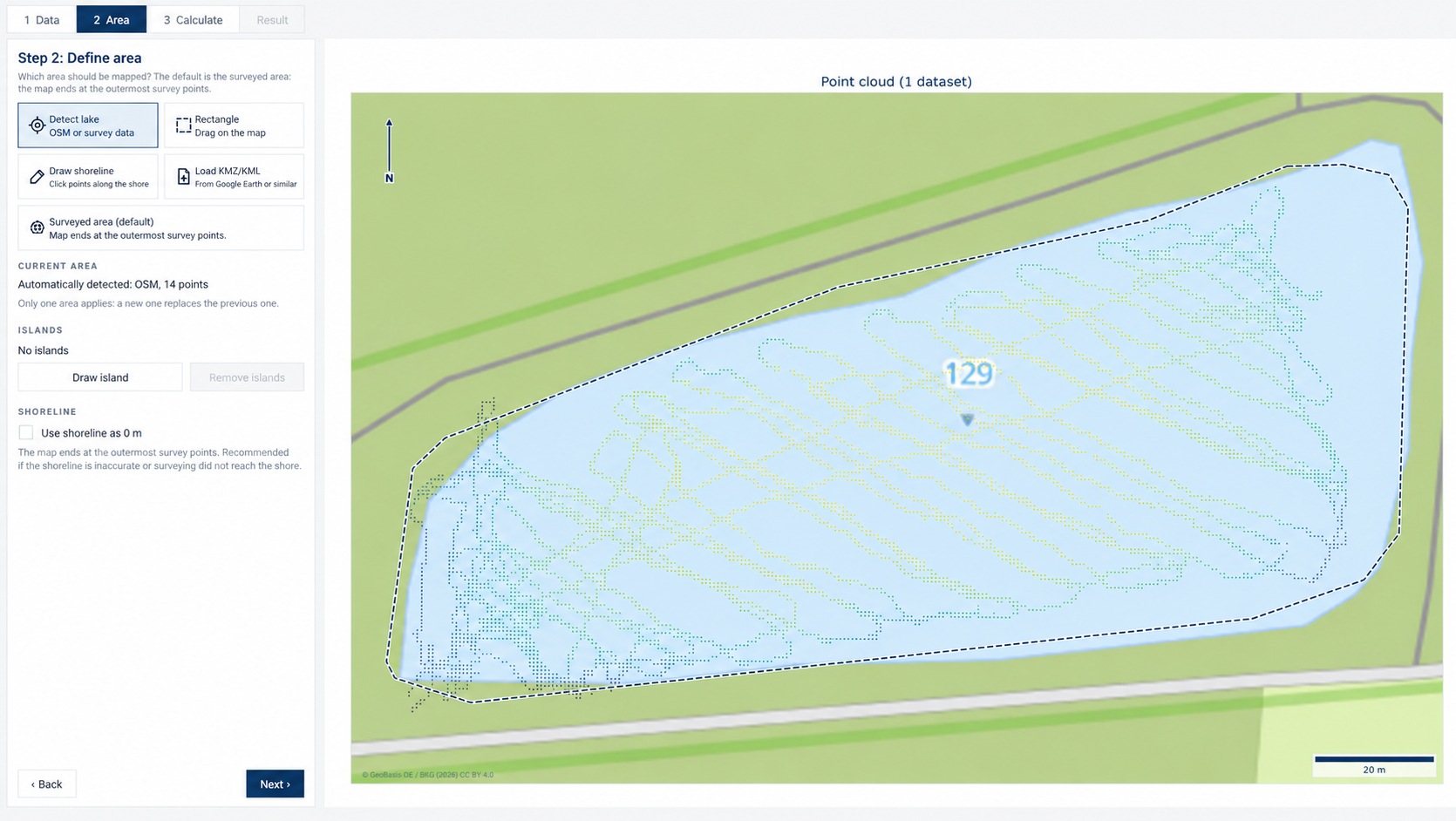
SonarMapper takes the outline of the lake from OpenStreetMap or wraps it around the outermost survey points. Or draw the shoreline with a few clicks, take a KMZ file from Google Earth and leave out islands. If you like, the map runs out to 0 m at the shore.
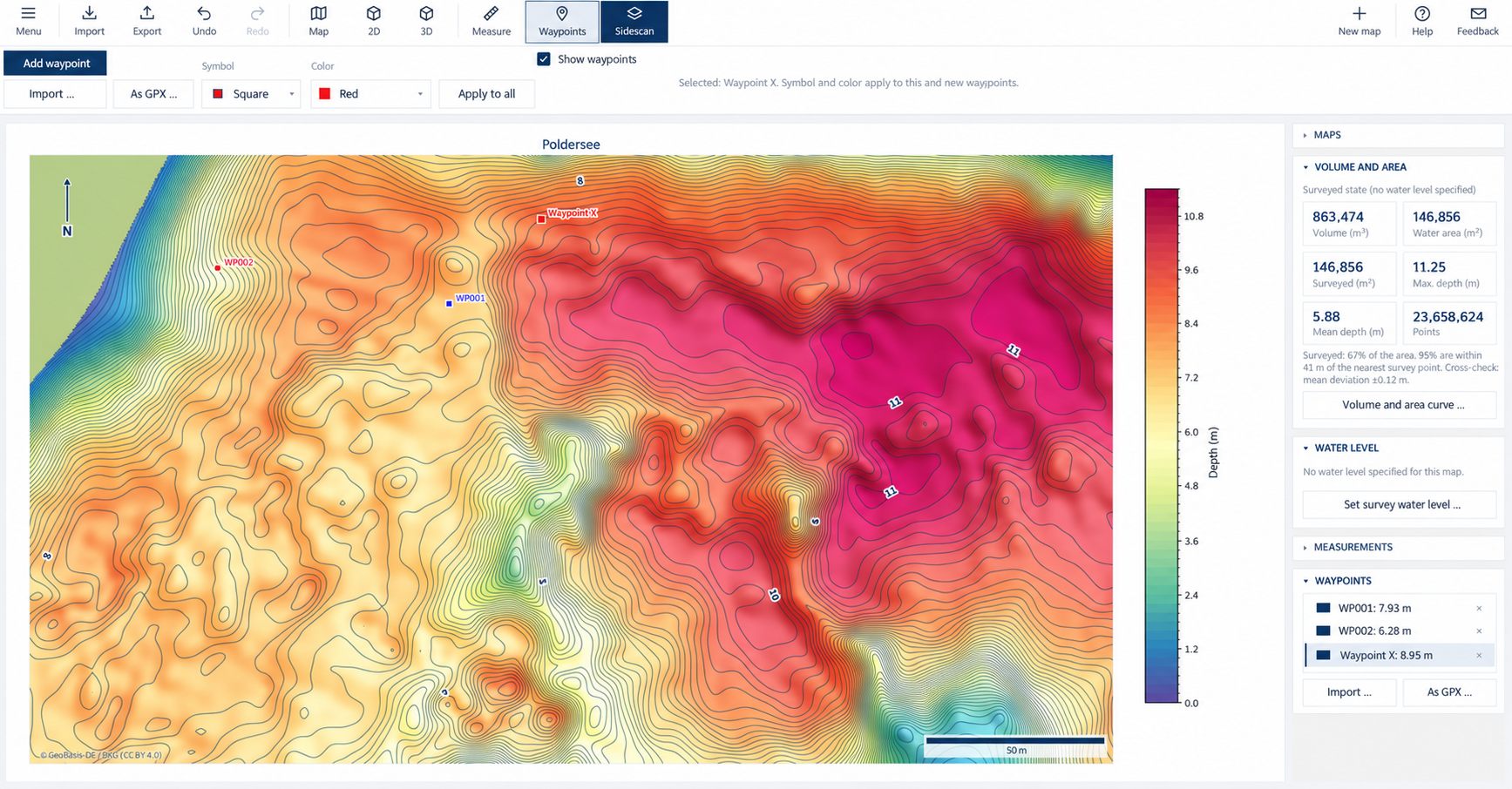
Smooth depth map with labelled contour lines and hillshade, optionally on top of OpenStreetMap or basemap.de. Set waypoints with symbol and color, load them from GPX or KML and send them back to your fish finder or GPS as GPX.
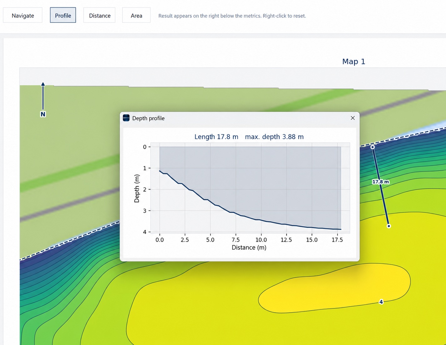
Draw a line across the map and see the depth profile right away, with length and maximum depth. Measure distances and areas directly in the map. Measurements are kept in the project and go into the report.
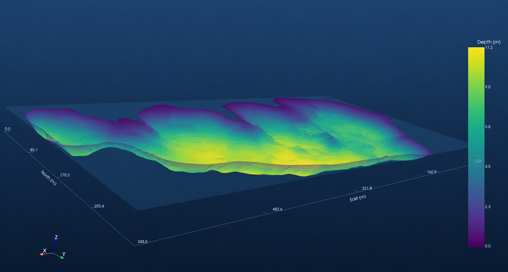
Rotate the bottom freely, true to scale. Runs without a graphics card, in virtual machines and over remote desktop.
Lowrance/Simrad (.sl2, .sl3, .slg), Humminbird (.DAT with folder), Garmin (.RSD) and point data as CSV/XYZ in degrees or UTM, plus GPX tracks. Several runs are merged into one map.
Volume, water surface, maximum and mean depth. Later water levels with date, volume and area curve.
For every map: how much of the area was actually measured, how far it is to the nearest survey point, and a cross-check. Suspicious values are marked, never silently removed.
Report with map, key figures, processing and measurements. Export as GeoTIFF, contour lines (DXF, shapefile, GeoJSON), Google Earth (KMZ) and map tiles (MBTiles).
Give each depth range its own color and save it as a scheme, for example to highlight exactly the depths that matter.
All calculations run on your computer, no cloud. Internet is only needed for activation, background maps and updates. Program, manual and report are available in English and German.
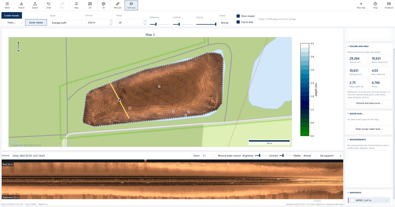
Side-scan recordings from Lowrance, Humminbird and Garmin (SideVü) as a mosaic on the map. The mosaic goes into the PDF report and, as GeoTIFF, Google Earth (KMZ) or map tiles (MBTiles), into other programs.
€49 incl. VAT added to your license at any time, also right from the program. It continues at no extra charge when you renew.
Add side scan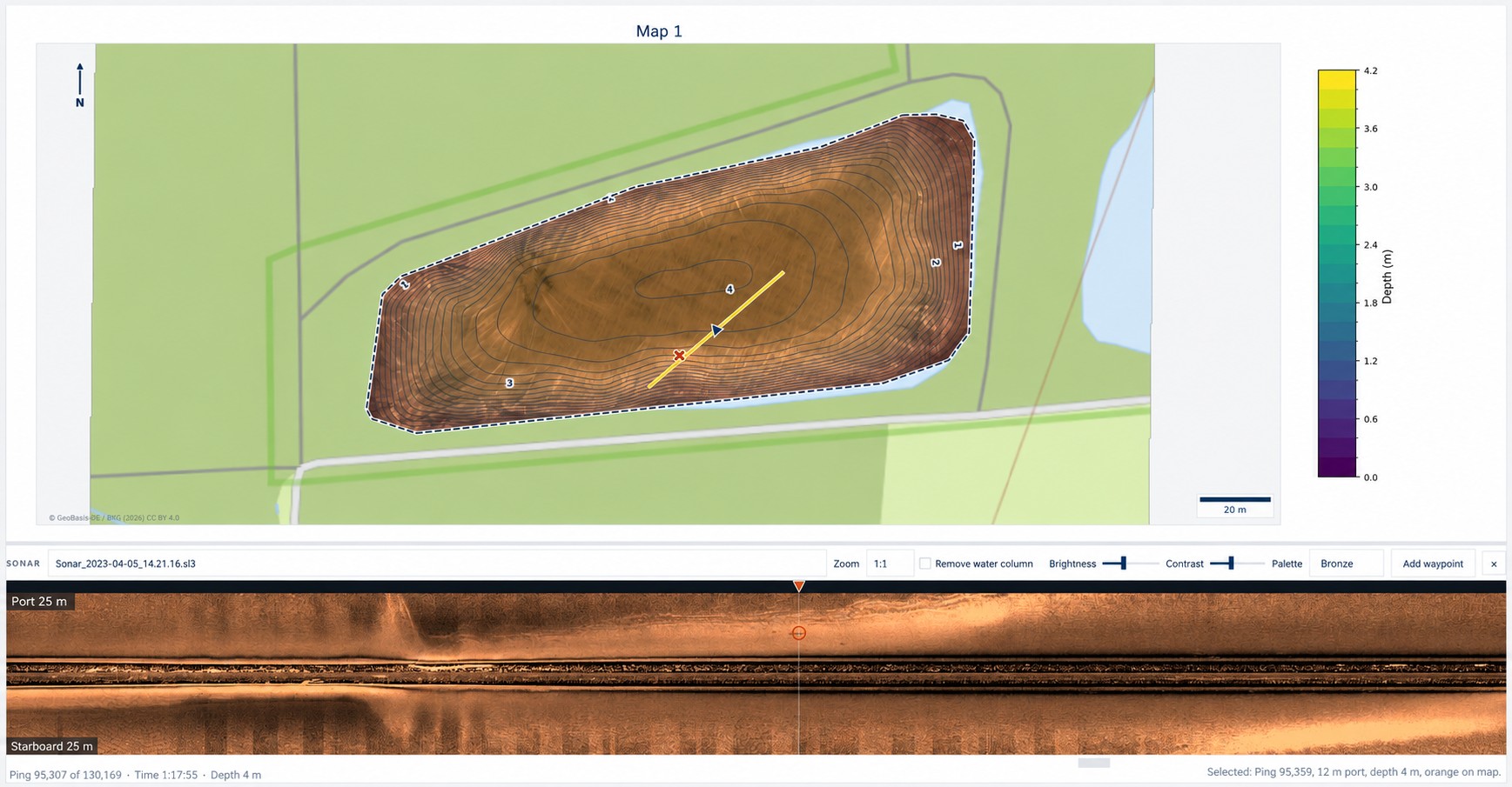
Scroll through the run as a sonar image below the map, port at the top, starboard at the bottom. The spot is marked on the map, a click on the map jumps to the matching place, and a marked spot becomes a waypoint.
Really know your water: find drop-offs, holes and plateaus, build color maps for the depth you are after and send good spots back to your fish finder as waypoints. See structure on the bottom with the side-scan module. Clubs map their waters and record depth and volume.
Document waters, calculate volumes in a traceable way, search for objects with the side-scan module and pass results on as a report. Works completely offline, with offline activation for computers without internet.
After your purchase you receive your license key by e-mail. Enter it once and you are done. The license is valid for 2 years on 2 computers, all updates included. For computers without internet there is an offline activation by e-mail. The license terms apply.
SonarMapper reminds you four weeks in advance. After that you can renew for one year at a time for €39 incl. VAT, right from the program; add-on modules continue. No subscription: without a renewal, use ends 14 days after expiry. Your projects, exports and reports are kept in any case.
Lowrance, Simrad, Humminbird or Garmin with a recording function. Alternatively, import point data as CSV/XYZ from any source.
As accurate as the survey. Between the survey lines the depth is interpolated; how reliable a map is, the quality figures in the program and in the report show. SonarMapper does not replace an official survey.
Windows 10/11, 64 bit. No graphics card required. Internet is only needed for activation, background maps and updates.
€249 incl. VAT for 2 years, with 2 device activations, all updates and e-mail support, afterwards optionally €39 per year (no subscription). Download, no shipping costs. Side scan as an add-on module for €49. The license terms apply.